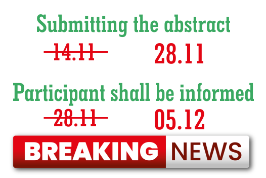
Symposium Program
Program Geomat 2021 (click here)
ABSTRACTS
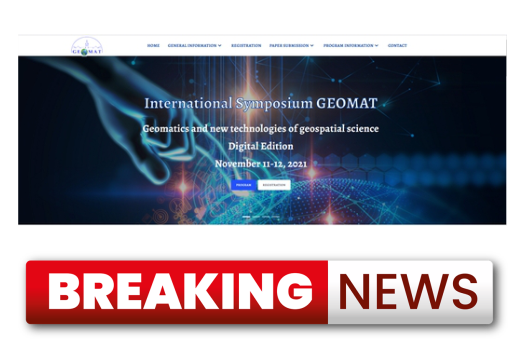
* International Symposium GEOMAT 2021 *
1. Iuliana Maria Pârvu, Petre Iuliu Dragomir:
3D building modelling based on ALS point clouds
Local and central administrations need a virtual representation of their cities. The elements in the 3D city models that I will emphasize in this presentation are buildings. DSM is usually used for 3D building models. Unfortunately, these models do not contain semantic or geometric information and do not allow the differentiation between elements and the realization of analyses, simulations, etc. 3D models in which each building is individually represented can be reconstructed from photogrammetric images, point clouds (either LiDAR or photogrammetric derived), ground footprints or a combination of these types of data.
2. George-Calin Baltariu, Constantin Bofu:
A GIS for the pedological soil mapping of Popricani area in Iasi County
The main purpose of the article aims in creating a GIS application for the pedological soil mapping of Popricani area in Iasi County with an eye to a further efficient utilisation of it by the end user, using web technologies, VBA and AutoLisp. Also the application includes an inventory of all the pedological data of the region. Other undertaken and proposed objectives are represented by creating an attribute database, relationing that database with graphic entities, making analysis, queries, thematic maps and creating a complex system that eases the end user experience and productivity.
3. Iuliana Adriana Cuibac Picu, Petre Iuliu Dragomir:
Accurate geospatial data for Oradea Smart City
The purpose of this presentation seeks to improvement the concept of Smart Cities by providing accurate geospatial data. These geospatial data, obtained by active remote sensing methods, such as airborne laser scanning technology (ALS) and improved by gravimetric methods, offer the possibility of obtaining a digital surface model (DSM) with high accuracy. The obtained DSM will be generated, through the most precise interpolation methods, obtained by different tests and comparative studies, in order to subsequently, develop an application in GIS environment In order to demonstrate the importance of accurate geospatial data, such as the DSM for Oradea city, an analysis of solar radiation of roofs and walls of buildings in GIS, related to the smart city Oradea, has been performed.
4. Ioana Chiriac, Livia Nistor-Lopatenco, Ana Vlasenco:
Spatial Information Management in creating of Digital Atlas of Moldova
The article presents theoretical-experimental argumentation of the methodology for creating digital geographic atlas for schools of Moldova using GIS technologies. The theoretical part of the argumentation includes the development of the structure of the geodatabase. In this part is described the mathematical basis of database, used for maps of Moldova and a list of features classes for the thematic maps. The experimental part of the argumentation includes description of the process of geodatabase creating, collection, processing, and presentation of geospatial data. In the final part of the article, some of the thematic maps of the Atlas are presented.
5. Loredana Mariana Crenganis, Claudiu Pricop, Maximilian Diac:
Floodplain Mapping Using ArcGIS and HEC-RAS: A Case Study of U.A.T. Ungheni, Iasi county, Romania
Hydrodynamic modelling and hazard maps are the basis for design and planning activities in order to create scenarios for reducing urban floods and spatial planning. A significant deficiency of most computer models used for stream floodplain analysis, is that the locations of structures impacted by floodwaters, such as bridges, roads, and buildings, cannot be effectively compared to the floodplain location. This research presents a straightforward approach for processing output of the HEC-RAS model, to enable two- and three-dimensional floodplain mapping and analysis in the ArcGIS geographic information system. The methodology is applied to a reach of UAT Ungheni Iasi County, Romania) Results obtained with HEC-RAS model were used in combination with ArcGIS to prepare floodplain maps for different return periods. Through floodplain maps, areas that are vulnerable to flooding hazards have been identified.
6. Maximilian Diac, Loredana Mariana Crenganis, Vasilica Alexandru Oprisanu, Ioan Balan:
GIS network analysis in landslides and flood risk management
The widespread use of geospatial technologies is generating an increasing volume of data. Due to this fact, it is necessary to draw up flows of processing and analysis of existing spatial data, in order to make decisions as accurate and fast as possible, especially in emergency situations. In the present study, several sets of raster DEM data, polygon vector and network are used, as well as GIS analysis tools, in order to manage the various risks, as efficiently as possible. The GIS analyzes that were applied are the network and slope slope analyzes, that aim to establish the proper location of the refugee camp in the flood scenario with a probability of exceedance of 0.1% on the Jijia River, Ungheni area, Romania, but also the management of areas affected by landslides risk of land. The flood risk was established on the basis of hydrological flood risk modeling according to Directive 2007/60 / EC of the European Parliament and of the Council of 23 October 2007 on the assessment and management of the flood risks, and landslide risk was modeled in GIS according to the described methodology in Government Decision no. 447/2003 for the approval of the Methodological Norms regarding the elaboration method and the content of the natural risk maps of landslides.
7. Agapie (Mereuţă) Ioana, Luca Mihail, Mereuță Daniel, Loredana Mariana Crenganis:
Comparative analysis regarding GIS interpolation methods in the problems of spatial analysis and obtaining MDT
Interpolation methods are essential tools for generating the Digital Terrain Model (MDT). Making a comparison between different interpolation methods in the GIS environment, by using the Geostatistical Analyst function, will indicate the degree of accuracy of each method. The quality of the Digital Terrain Model (MDT) depends on the accuracy of the measured data, the techniques and software used in the measurement processing stage. In this paper, three interpolation methods available in ArcGIS software are analyzed: Inverse Distance Weighted (IDW), Local Polynomial Interpolation (LPI), and Kriging. Two scenarios were considered in the study: in the first, an area with a steep slope was analyzed, in the second scenario, a gently sloping area was analyzed. The techniques for performing topographic measurements were of the modern type, respectively the current use of satellite technology. Measurements for both scenarios were performed using GNSS technology and the RTK method for determining point coordinates in real time. The location of the studied areas is in Iași county, Miroslava commune.
8. Agapie (Mereuţă) Ioana, Luca Mihail, Gherasim Paul Marian:
Monitoring the stability of earthdams using local geodetic networks
Monitoring the behavior of earthdams over time requires that they be permanently equipped with their own tools and control points. Monitoring is performed according to the importance category of the objective, control parameters, but also the specific conditions of the location. The paper presents a modern way of tracking structural deformations in the case of earthdams, owned by private owners, in order to assess their operational safety. The study area is represented by the Piscicola Podișu accumulation located on the Valea Oii river in Iași county. For the location of the earthdam, measurements were made for the creation and monitoring of the local geodetic network. The network consists of reference points (S1, S2), station points (B1, B2, B3, B4) and control points (P1-P11) located on the studied dam. The way of working involved several stages. In the first stage, the site recognition and the monitoring requirements of the dam stability parameters were performed. In the second stage, the conditions for carrying out the measurements for drawing up the situation plan and designing the geodetic monitoring network were analyzed. In the third stage, measurements were performed for the design of a local GNSS geodetic network. The purpose of this paper is to design and analyze GNSS measurements in the monitoring of earthdams with modern technologies.
9. Paul Sestras, Sanda Nas, Ioel Veres:
The use of UAS and GIS spatial analysis in cadastral surveying and technical documentations
Keywords: UAV, GIS, Measurement, Spatial Analysis.
10. Valeria-Ersilia Oniga, Ana-Ioana Breaban, Norbert Pfeifer, Maximilian Diac:
Semi-automatic workflow for 3D building models generation based on UAS images
Keywords: UAS point cloud; segmentation; classification; machine learning; 3D model; urban area
11. Mihail Luca, Nicolae Marcoie, Violeta Dominte (Croitoru), Ioana Agapie (Mereuta):
Considerations regarding the verification of the topographic drawing parameters of structural components at earth dam
The paper presents the importance of verifying the parameters for tracing the structural components of earth dams in technical expertise. Between the design phase and the execution phase of the structural components of the earth dams, a series of deviations can occur in the topographic tracing in the field. This situation can influence the behaviour of some structural components of the dam to the actions on site, or to those of hydrological, hydraulic and seismic nature. The case study prepared within a technical expertise at an earth dam in the area of Moldova highlights a risk in operation of the outlet structure generated by non-compliance with the topographic elements. The risk is determined by the execution of a section of the channel that transits the flood wave. By topographic measurements performed within the expertise, the real longitudinal profile of the channel in the executed variant was achieved. The behaviour of the channel during the transit and evacuation of floods at the new longitudinal profile was verified with hydraulic analysis software. The results obtained confirm a faulty behaviour of the channel. Structural changes in the high water outlet influence the operating behaviour of the dam and may induce its partial or total degradation. The analysis confirms the need for changes over time in the topographic documentation used in the execution of earth dams.
12. Cucuteanu Adelina-Cristina, Todirica Ionut-Emilian, Zaborila Anca, Topolniceanu Alexandru, Catrinel-Raluca Giurma-Handley, Petrica Cercel:
Open source flood mapping tools – QGIS, river GIS and HEC-RAS
Maps give a more direct and stronger impression of the spatial distribution of the flood risk than other forms of presentation (verbal description, diagrams). Thus, maps are valuable for presenting and assessing the local flood situation, and they provide information for many applications in flood defence and disaster management. Since the start of geospatial open source “revolution” in the early 2000 (that began with QGIS launching), a transition from commercial software to open source alternatives has been noticed among researchers, professionals, local administrations, etc. This study focuses on using available open source solutions in order to obtain useful information regarding the delineation of flood hazard and flood risk areas. QGIS functions as geographic information system (GIS) software, allowing users to analyze and edit spatial information, in addition to composing and exporting graphical maps. RiverGIS is a QGIS plugin for creating HEC-RAS flow model geometry from spatial data. The functionality is similar to that of HEC-GeoRAS. For data store and spatial operations it needs a PostGIS database. RiverGIS is free/libre software and is released under the GNU General Public License. The methodology used proved efficient considering the time, cost and the quality of the output. The results managed to capture and delimitate the flood. Taking into consideration the cost related issues, this methodology can be applied easily by all the interested parties (local communities, local authorities, scientists, responsible persons with flood mitigation) in the development of local, regional or national flood management plans.
13. Anișoara Filip:
Paraglacial geomorphological transformations and palaeoclimate changes in Rodna Mountains
As a mountain area affected by the Pleistocene (de)glaciation, Rodna Mountains’ alpine environment presents the features of formerly gravitationally unstable slopes as the result of the morphoclimatic adjustment of the slope at the beginning of the Holocene period. Debuttressing, perturbations of hydro-mechanical and gravitational stress influence the development of rock-slope deformations, known as paraglacial geomorphological features. The different forms that they take are promoted by local differences in topography, rock properties, and deglaciation patterns. Digital maps of geological, geomorphological, and climate-related features and processes were combined statistically to form a geographic information system. The main goal of the study is to identify and analyze the relationship between the factors favoring the generation of slope geomorphological processes and the spatial distribution of rock-slope failures in Rodna Mountains, in order to obtain a clear view of the conditioning and triggering factors.
14. Postavaru Alexandru, Ion Giurma:
Reaserch and case studies on water losses in distribution networks and their effect on the groundwater
The current paper approaches the possibility of using the devices owned by the Company I work for, namely the G.P.R. (Ground penetrating Radar), U.A.V., thermal imaging camera, for the purpose of loss detection both on drinking water distribution and transportation pipes. The paper comprises a series of cases we actually encountered on site and successfully identified using the Geo radar and pre-encountered with the thermal cameras and drones. The cases are explained, illustrated with on-site images and have been confirmed by visual inspection in the respective areas and by other devices on Mobile Laboratory for Loss Detection and by conducting surveys (mechanized excavation) at those specific points. In conclusion, the methods used in the field to identify water losses can have good results as a secondary procedure for leak detection. These equipments like G.P.R., U.A.V. and thermal imaging camera, should not be perceived as universal replacement of all the so far existing devices , either in terms of loss identification or in terms of utilities identification, as it is a complementary device on certain loss detection segments.
15. Paula Stoica, Ioan-Corneliu Marțincu, Catrinel-Raluca Giurma-Handley:
Watershed delineation using digital elevation model in ArcGIS
The watersheds can be useful in defining the boundaries of the basin or to divide that basin into subbasins. This case study aims to create a boundary that represents the contributing area for a certain pour point. The watershed is delineated from the DEM (Digital Elevation Model) by calculating flow direction and flow accumulation and using them further into the analysis. To achieve this, ArcGIS will be used to perform the analysis leading to watershed delineation.
16. Martincu Ioan-Corneliu, Zaborila Anca, Todrica Ionut-Emilian, Stoica Paula, Giurma-Handley Catrinel Raluca:
Comparative analysis of the infiltration model in an urban catchment
As urbanization continues to expand due to decreasing of pervious area, there is a need to quantify its negative impacts on the hydrological level. The infiltration properties of the soils and the piezometric level have a direct impact on the hydrological behavior of urban catchments. The variety of these characteristics necessitates the use of appropriate infiltration models and should be included in urban hydrologic modeling. Hence, high accuracy models are a necessity in the management of the urban floods. This paper investigates the variability of the water depth on a urban catchment in Beilen (Netherlands) represented using the GIM. A 2D model was used to simulate the infiltration of water into the ground and model pluvial flows at an urban catchment scale. Water levels were satisfactorily simulated by the model. Comparative analysis reveals soil parameters are very sensitive.
17. Andrei Pavaleanu, Ion Giurma
Local water supply systems deficiencies and safety measures. Case study
This paper presents the deficiencies in the execution of the water supply system of Territorial and Administrative Division Alexandru cel Bun, Neamt County deficiencies that led in January 2021 - February 2021 to the impossibility of supplying drinking water to the population. At the same time, the measures taken to ensure the functioning of the system will be presented, as well as the projects and investments made in the short and medium term to restore the system in parameters. In some areas, a rethinking of the pressure management is described, with the help of which a reduction of the losses from the distribution network was managed, as well as the provision of the necessary flow for a certain target group of users. The pressure management also involved the modification of the pumping parameters in the pressure lifting stations related to the system. By introducing an integrated partial monitoring system and its interconnection with the SCADA department, it was possible to monitor both the tank level and the network pressure, as well as the operation of the pressure lifting stations. Since the water supply system of Territorial and Administrative Division Alexandru cel Bun has two components (abstraction-tank-distribution) that have a non-functional interconnection (deficiencies of execution) at present, this paper will deal with an analysis of the specific and subsequent consumption of investments needed to restore the interconnection between the systems and reduce operating costs but also network losses.